Free and Professional Modifiable Map for PowerPoint Presentations
PowerPoint presentations have become essential in the professional world. So it only makes sense that we have seen a number of unique applications emerge over the past few years. The free Editable Worldmap for PowerPoint slides is a great example of how these systems have become intuitive and highly functional. It provides the user with multiple ways to present and modify a map based off of unique criteria.
Functions and Uses
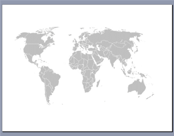
This free Editable Worldmap for PowerPoint is simple to use and it can be modified in only seconds. It displays every country and continent in the world while the user can colour code areas or regions for specific purposes. Cities are also listed allowing for easy identification and avoiding the need for geographical research in advance. This software is a great solution for highlighting the importance of certain areas for listing cities within a marketing campaign and indeed for everything in between.
Additional Tools at Your Disposal
Users can also create legends to suit the purposes of the presentation while over 50 unique markers (such as points of interest gas stations and businesses) can be added when may be necessary. This free Editable Worldmap for PowerPoint is therefore extremely useful when a bit of 'snap' is required for an upcoming presentation or seminar.
User reviews about Free Editable Worldmap for Powerpoint
by Anonymous
high quality, easy-to-use map frees my design time..
Fantastic tool that is simple and intuitive for non-artists to use, frees up my design time and gives my sales team the opportunity to change their regional maps quickly and easily. More
by Anonymous
A great tool but not geographically accurate.
Easy to use and looks good in publications but why isn't Greenland included? And the Faroe Islands? And why is Ireland in 3 parts?
Pros:
Countries can be quickly shaded
Cons:
Not all countries are represented More
by Anonymous
Exactly what I was looking for!!!.
Great functionality to color code countries. Best free formattable map I have found!
Pros: Ability to color code countries
Cons:
Labeling? More
by Anonymous
Easy to use. Saved it as a PDF and inserted into my word document, GREAT!.
Easy to use. Just saved it as a PDF and then inserted into my word document. GREAT. Pros:
Easy to use.
Any colors, even just B&W
Cons:
Some of the country outlines are vague or overlap More
by Anonymous
Functional and fully editable, a brilliant idea!.
This slide is amazing! Unlike the image version the edges of landmasses don't blur and you don't miss anything, and each country is fully editable! I recommend making a version of this with states as well, it is awesome!
Pros:
Integration into Powerpoint
Editability
Cons:
There are no cons, but I would like to see a version with states. More
by Anonymous
Works great. Needed this for my work..
Just downloaded. I was skeptical at first, thinking it might be an EXE file. But it is just a PowerPoint 2003 file and every country is a shape. So you can change colors easily. Thanks! More